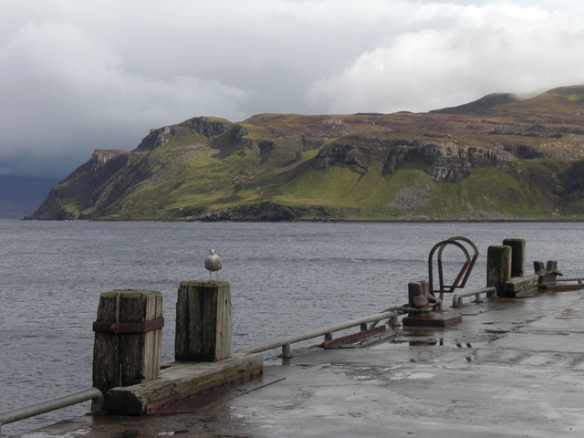
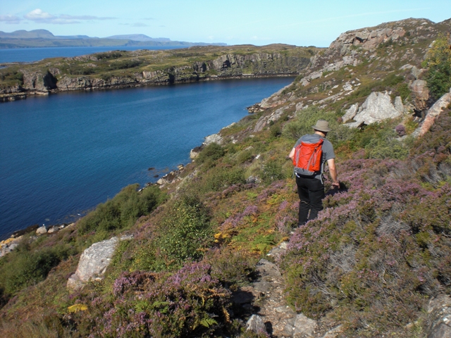
An Aird Peninsula

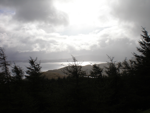
Our week on Skye sadly was as dominated by rainfall as one might expect then. Sometimes the sky was pelting us with rainstorms, sometimes it was just a drizzle. From the left, from the right, and just when you thought the rain would never stop it changed to fickle showers. We went out regardless, hopeful to see the seals despite the weather. In order to get used to the climate and the tracks though, we first picked a few shorter routes nearby. The tour around the An Aird Peninsula is recommended for less experienced hikers. As long as you’re not deterred by the droppings from all the sheep, that is.

Due to the deluge that day though, we were so drenched that we decided to cut across the peninsula. But the heath was so thoroughly flooded that it almost took my boots off. For the first time I was relieved having spent that much money on our boots as my feet stayed dry and warm. And, well. The poo falls off, once your boots dried up.
Excursion into the past
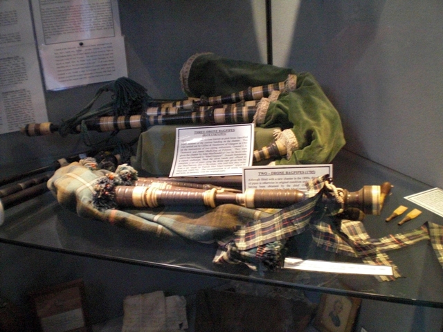
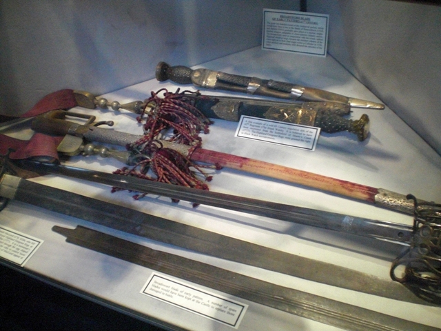
In case you’d had it with the rain you can visit the history centres of the clans MacLeod and MacDonald, which inform you not just about the history of Scotland in general but also in great detail about the clans. Apart from the actual destination even the road there is worth the trip. Whenever the sun breaks through the gray you can enjoy the beautiful view of the lilac blooming heath.
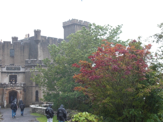
We first went to the Waternish Peninsula to visit Dunvegan, allegedly the oldest, permanent castle residence. Serving as the seat of clan MacLeod for over 800 years.
Returning from Dunvegan via the A863 you’ll eventually come past the junction to the Whisky distillery of Talisker, which is the only one on Skye. If the wind is right you’ll just have to follow your nose. Although we didn’t bring the Whisky from Skye directly since you can comfortably order it from home. Which is cheaper, too.
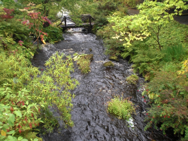
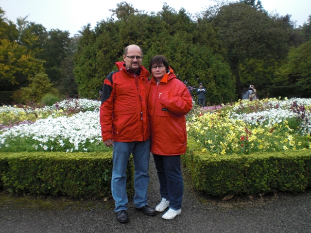
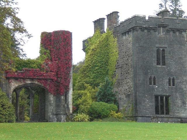
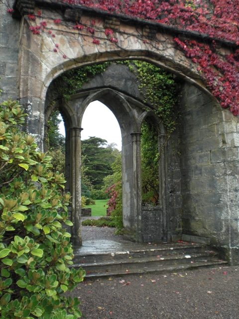
On the peninsula of Sleat in Armadale you’ll find the MacDonald centre. Although the castle itself is a ruin the exhibition in the neighbouring complex is superbly organised and teaches plenty of in-depth knowledge about Scottish history. If the weather clears up you should also check out the gorgeously laid out gardens and parks around the building. It is always astonishing how such plants can thrive this far north.
Trotternish with Portree
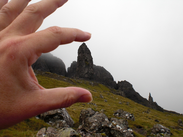
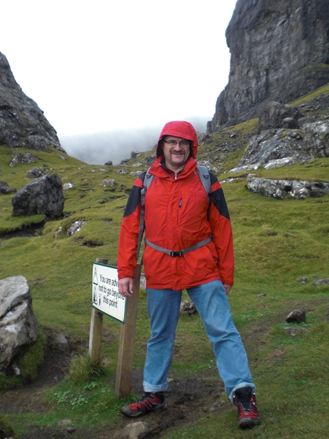
Skye’s most popular hiking route is probably the track leading to the ‘Old Man of Storr’ and we had to head up their despite the precipitation.
The starting point is a parking lot next to the road leading from Portree to Staffin. The path leads continuously up the hill as you leave behind the forest. This day happened to be one of capricious weather, ever switching between more rain and intervals of sunshine, followed by more clouds. A play of light and shadow that painted beautifully on the bare landscape.
The stone pillars don’t even seem terribly large from below, but the closer you get the more you realize their impressive dimensions. And since that area is commonly threatened by landslides one shouldn’t walk behind the Old Man.
If you followed the road from Portree this far you might as well drive all the way around Trotternish as well, the only of Skye’s peninsulas where you can. The “Skye Museum of Island Life” is worth a stop if you continue on the coastal road. Alternatively you can cut across the peninsula from Staffin to Uig. But you’ll have to have mastered the art of the right hand drive car by then, since most of the roads are single track. If one so desires he can even explore the Outer Hebrides with his car, by using a ferry from Uig. We’ll certainly do that the next time around!
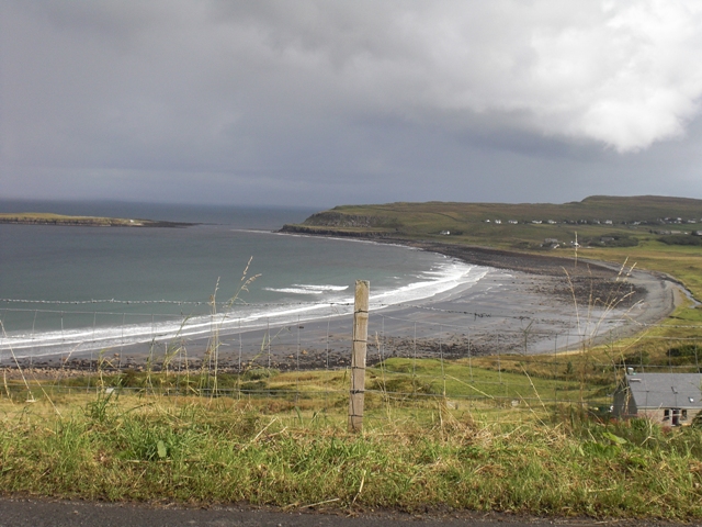
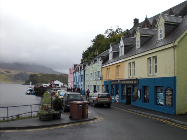
The circuit around trotternish ends in Portree again, the capital of Skye. Should you be yearning for the city busy life by now this is where you’ll find relief. The most prominent photo opportunity is the pastel coloured row of houses directly at the harbour… Which would probably look a lot better in the sunshine, but there’s hope we’ll have more luck next time we visit!

Raasay
If the many hiking trails on Skye itself still leave you wanting you also have the option to take a ferry across to Raasay. The small ship leaves a few times a day from Sconser, you simply queue up with your car and come aboard once it’s your turn. Experts plan ahead and start their expedition in the early morning, as once you're on Raasay you can walk several tours.
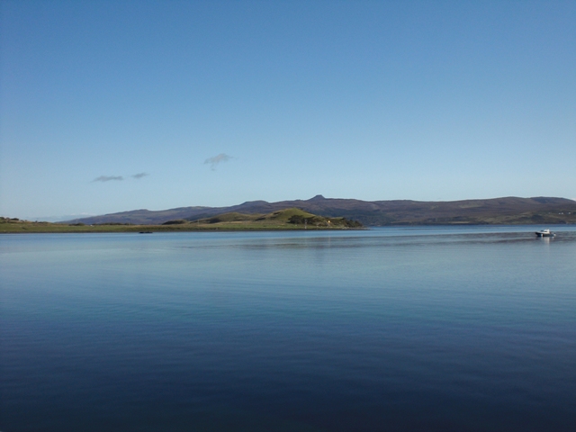
We had planned our visit for Thursday - and got lucky for once: Thursday was the only day in the week with clear blue sky and bright sunshine. Our guide book mentioned several routes and we chose to drive all the way to the northern edge of the island, hiking the path named ‘Calum’s Road, Torran and Fladday’.
Poor man Calum apparently spent 10 years of his life improving the road to Arnish so that cars would be able to use it. But once he was finished nobody in his hometown was left. By now though, people have returned to the north of Raasay, both Crofters and cottage owners. And everyone is using Calum’s road.
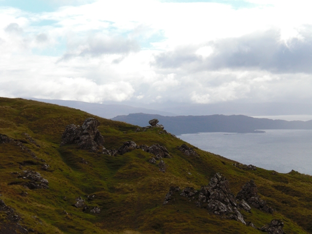
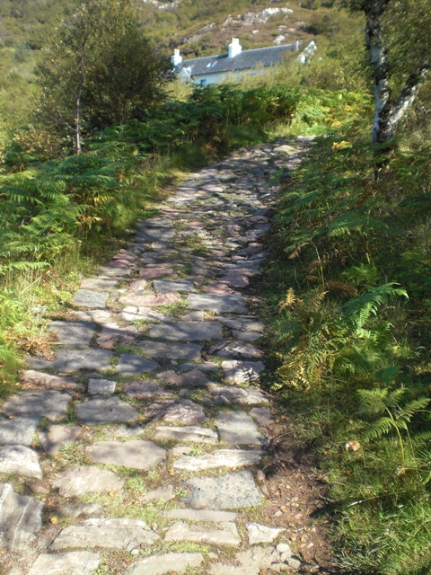
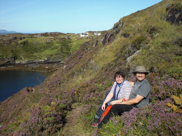
The hiking trail leads past the old school building, along the coast to Fladday, a small island off the shore. At low tide you can actually walk over there. While you’re hiking on the coastal trail though it would be best if you weren’t afraid of heights - as the cliff is steep and the Atlantic merciless. For our way back we took a shortcut across the lilac heath again, with a magnificent view over to Skye and the ‘Old Man’.


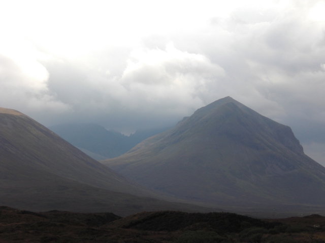
Cuillins
I am not a mountaineer. Should I ever feel the urge to actually climb the Cuillins, the weather needs to be better, but in this mix of rain and fog - no thanks!
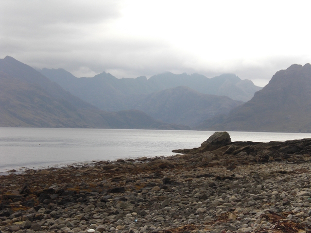
Nevertheless: Skye without the Cuillins just doesn’t work. I remember this old novel by Mary Stewart, ‘Wildfire at Midnight’, which plays out in the 50s around the coronation of Elizabeth Windsor. This book had fascinated me since I was a small girl. The story takes place right here, in the Cuillins around the Blaven. And I just had to explore the area to see for myself whether the book was accurate. If I recall correctly the protagonist even ferries over from Elgol.
We took the single track road however, which leads past the southern edge of the Cuillins. Lonely, barren, wild. Those are the words that first come to mind in this kind of place. Sure, every once in a while you’ll actually meet another car; mostly locals who are familiar with the state of the road. It’s always quite the adrenaline rush when another vehicle suddenly comes racing towards you over a hilltop! There isn’t really any space to swerve - next to the road, it’s a sheer cliff.
It was an exhausting drive but I wouldn’t want to miss a thing. Not the driving nor everything else we’ve seen that day.